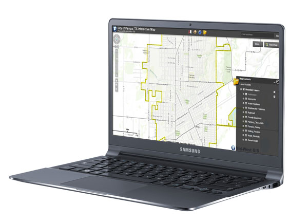
Mid-West GIS has just released the new version of the Pampa, Texas Interactive GIS Map. In 2007 Mid-West GIS began the development of over a dozen GIS data layers for the City of Pampa. Once the GIS system was deployed and in use by the city, Mid-West GIS began work on taking the GIS System to the web. The plan was for the new site to be used by not only city staff who needed to view GIS data for their work related tasks, but for citizens to have the ability to view and use the data as well. In 2008 the first version of the website was released. Over the next six years there have been updates and changes to the Pampa GIS website as new features were added, software and hardware solutions were updated or changed, and server solutions were upgraded. Today we have launched the most recent version of the interactive map. The new site offers more functionality, is much quicker, and more user friendly. You can see the new interactive map by visiting http://www.maps.


 Mid-West GIS was contracted by the Hannibal Board of Public Works in 2012 to do a complete field inventory and update existing GIS data for their Electric Distribution System Utility Database. This included over 350 miles of line and 9,455 utility poles. The data had already been converted into a geodatabase, but needed field verified as well as additional data added that was missing.